Friday, June 28, 2013

Port Germein and Adelaide SA

We arrived at Port Germein settled into the only caravan park there and went to explore the small, coastal town on the west coast of Spencer Gulf that has or had the longest wooden jetty in the southern hemisphere, at one stage (until it lost 165 metres off the end in a storm), it is now 1,500 metres long - that's a three kilometre walk to the end and back.
Port Germein Jetty 1,500 mtrs
It seems to go on forever.
We started the walk but only got as far as the water, about halfway, where we saw the tide coming in at a fast flow. We had to walk fast back towards the shore so as we could get the photos taken from the sand. It was originally used to get wheat onto the ships by horse and cart and had a larger section at the end where the carts could turn around (didn't seem wide enough for two carts to pass). The Water Depth Gauge was the first we had ever seen and was large enough to be seen from deeper water so as the ships knew whether or not they could dock - it used to be at the end of the jetty together with a small lighthouse.
Water Depth Gauge - no longer in use
The next day (Thursday) we left and went to the closest caravan park to Adelaide city centre and just across the road from the Adelaide Botanic Gardens. We had time that day to walk through the gardens, which were quite nice, with sculptures everywhere, as well as plants and flowers, but being Winter, not many were blooming.
 Natural Beauty & Harmony @ Adelaide Botanic Garden

Adelaide Botanic Gardens - Amazon fighting Lion on horse
They had a very modern building devoted to the Giant Amazon Water Lilies which was heated to create their natural habitat - hot and humid.
Amazon Water Lillies
As we have never been to Adelaide before we decided to do a bus tour of the city and surrounds, so on the Friday we did just that starting out with a pick-up at 8:30am and getting back by 5:30pm - it was a long day but quite interesting and enjoyable. We had hoped that we could get a tour that showed all of the churches of this 'City of Churches', but we was told that a lot of the churches had closed and are now restaurants, medical suites or shops, but we did see the main ones, which are still churches, but didn't get to go inside - I guess most people aren't interested in churches any more. 

We had a good driver/tour guide who drove that coach through the busy city streets whilst sprouting heaps of information about the city, its history and what building was what and if it was now a heritage building or not (most any building over 50 yrs old in South Australia seems to be on the heritage list). Colonel Light in 1836 was given the task of finding a suitable site for Adelaide City (named after King William's wife) and had much opposition to the site he chose, but in the end it turned out to be the best for the climate and countryside - he planned it so as it could be defended from cannon-ball and musket fire by locating four green areas (parks - still used as parks) big enough so as a cannon-ball or musket shot couldn't reach the main streets of Adelaide from the end of these parks. 

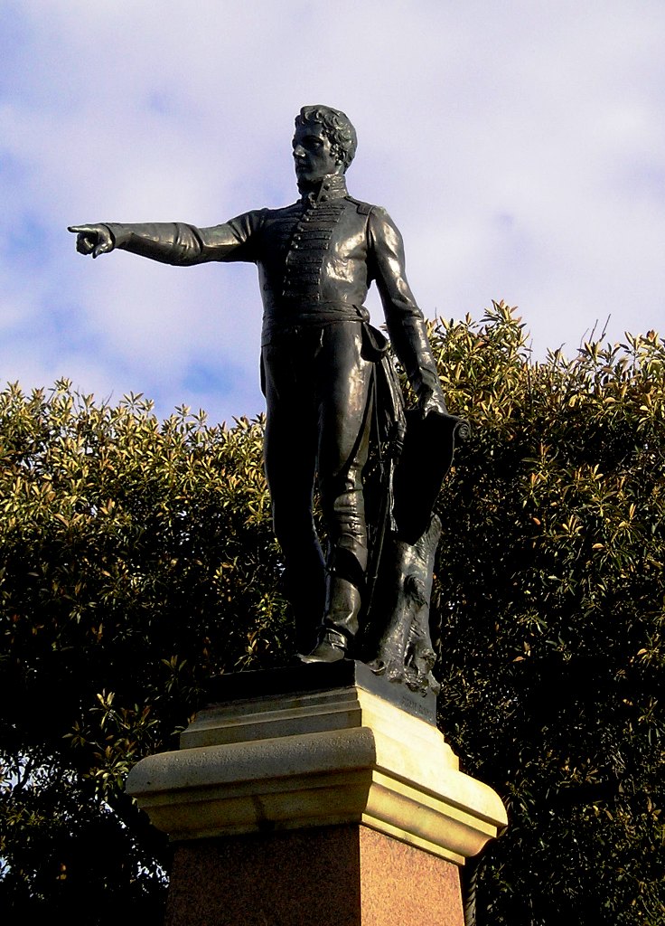
So our first stop was Light Park that overlooked the city, but there is so much construction work going on that all we really saw was his statue in the park surrounded by large cranes accompanied by the sounds of jack-hammers and the beep-beep-beep of diggers and trucks turning and backing up.
Colonel Light overlooking the city of Adelaide
Then we went to the Haigh Chocolate Factory, a small boutique chocolate enterprise that mainly sells its chocolate products in South Australia, with a few outlets in Victoria and NSW. We had a short tour and a free sample and were then taken into their shop where we could buy some of their wares with a 5% discount voucher. Ruth and I headed for the seconds counter and bought some Rocky Road and slabs of coconut, peppermint and almond chocolate. It really wasn't any better than Nestles, but they apparently have a following and do quite well - it is still family owned and run. 

 From there we went to where the first settlers, settled, now a suburb of Adelaide called Glenelg. The driver said we could have a walk around for 20 minutes and said the Glenelg beach was one of the top ten beaches in Australia - so we had to see that, what a disappointment - maybe it was because it was Winter, but there was seaweed all over the beach and again, with so many of these so called top beaches, there was no surf. When I questioned the driver about this he said, this is a gulf so no proper surf here. I suppose it would be good in Summer for those who just want to get wet and cool down, especially for small kids.
Glenelg Beach and Jetty
We then went back to the depot (in the heart of Adelaide) for an hour or so break - so we decided to see the city markets and walked around there after a quick lunch and got lost, they are so huge - but finally managed to get back to the depot for the afternoon tour which left for Mount Lofty in the Adelaide Hills where one can get a good overall view of the beautiful city of Adelaide (voted as one of the best cities in the world to live). However, it was very cloudy and overcast, so we really didn't get to see the beautiful city of Adelaide from afar, but it was on the tour, so we went anyway and the driver was kind enough to take our photo with the city (clouds) in the background.
Mt. Lofty Looking out over Adelaide - haha
Then we had a nice drive through the Adelaide Hills and small villages ending up at the village of Hahndorf, which is a village that was settled by German Lutherans who had left Germany because of persecution and wanted to start life anew in the Great South Land of the Holy Spirit. It still has many of the original buildings and crafts and we had several hours to walk through the village and enjoy the ambience of the place. We were given a voucher for either 'coffee & cake' or 'a sampling of German beers' at the local German Tavern. Ruth & I had only had a light luncheon, so we decided that we would have a typical German Hot Dog with sauerkraut & mustard before we had our cake. They would only offer us a metre long hot dog and nothing smaller, so we left and found another smaller cafe where we got what we wanted - then just before we had to board the bus we went back and got our 'hot chocolate and cake', instead of the coffee.
 Ruth enjoying her Bratwurst, Sauerkraut & Mustard Hotdog at Hahndorf
The next day, Saturday, we went back to the markets in the morning and bought some fruit, veggies, cheese and goat meat as we were getting low on supplies - then in the afternoon we went to the Adelaide Zoo to see the Panda Bears (the only zoo in Australia that has them). We saw them, behind thick glass cages, with notices saying 'No Flash Photography' - not that it would have helped as the flash would have just reflected back off of the glass and spoilt the photo, but we did get to see one close up eating his bamboo. We also saw a lot of their very fibrous poos scattered all over the floor. They did have plenty of room outside where they could go, but after our third trip back to their enclosure we decided that they didn't go out very much at all.
Ruth with Panda
Bernie with Panda
We did see lots of other animals that you would see in most zoos and that was enjoyable - my favourites were the meerkats, just after I took that photo they were fed - one mouse each (this was their Saturday treat - the mice were dead, but they only had enough for one each).
Meercats at Adelaide Zoo
Cassowary at Adelaide Zoo
Baboon, showing his fangs, at Adelaide Zoo
We left Sunday morning and stopped of at the Enfield Baptist Church on our way north, now, towards Broken Hill.

Tuesday, June 25, 2013

Streaky Bay - Kimba SA

We left Nundroo on Saturday 22nd and reached the Ceduna "Fruit Fly Checkpoint" to be told that they were only interested in any thing that came out of the ground, like potatoes or carrots and also citrus fruit. Ruth had already cooked the potatoes, onions etc and we had eaten all of our fruit, so we didn't have to declare anything, but we could have brought in a lettuce (that we gave away at the roadhouse and our Boab tree seed pods that we threw away). 

So from there we drove down the coast of the Eyre Peninsula until we reached Streaky Bay where we decided to stay over for church on Sunday and leave on Monday. Streaky Bay is a small coastal village where everyone seems to know everyone, extremely well kept and looked after by the council and locals, with almost everything a small town could want except a Baptist church. 

Rugged Coast near Streaky Bay, SA
We took a walk on the Saturday afternoon along the bay, right next to the caravan park, and noticed that quite a few of the sea gulls there only had one leg, see photo - we actually disturbed them in case they had one leg tucked under their wing, but no, they actually hopped away from us as we drew close to them. What was happening? Well further along the beach we came across one gull that was having a hard time walking at all because it had fishing line wrapped around both of its legs, so we assumed that the one legged gulls lost their legs when fishing line caught around their leg, cut off the circulation, the leg died and then fell off. It was quite pitiful to see - this coastal area boasts that it is a great fishing area and is probably their main attraction. 

One-legged seagulls
The next day was Sunday and we had the Anglican or Uniting churches from which to choose - we chose the Anglican, and what a good choice it was because it is one of only a few evangelical Anglican churches in South Australia and the message was spot on. I found this out when I spoke to the minister after church and told him that he could have preached that sermon in any Baptist church and no one would have know he was an Anglican. He replied that he would hope that he could preach that sermon in any church and be accepted, but acknowledged that not all S.A. Anglican churches would. He preached from Galatians 3 and it was a full on salvation sermon and even had an invitation at the end for anyone who was serving the church, but hadn't accepted Jesus as Saviour in their lives - even mentioning that baptism didn't get us to Heaven. 

We walked back to the caravan park and bought fish 'n chips for lunch and stayed in for the rest of the afternoon as it was cold, drizzly and fairly miserable (and Ruth was getting worse). So first thing Monday we rang the local doctor and made an appointment for 11:30am, which was too late to carry on with our trip, so we decided to stay another night. After Ruth got her antibiotics and a nasal spray, we had lunch and did a short drive around the coast and saw some of its ruggedness and missed out again on seeing some blow holes blowing because the sea was quite calm and maybe the tide not high enough. 

We left Streaky Bay on the Tuesday and continued south for about 40 kms until we came across Murphy's Haystacks which are some very unusually shaped granite rocks on top of a hill and from a distance they could possible be mistaken for haystacks - see story in photos. We spent a good hour there walking amongst them - at the entrance they ask for $2 per person to be put in a metal honour box - it's on private property and the toilet and pathways have been provided by the property owner, so we thought that was fair. 

Murphy's Haystacks
Close up of main outcropping of Murphy's Haystacks.
Explanation for Murphy's Haystacks
Ruth on windswept side of one of Murphy's Haystacks
Just kicked the top off a small haystack.
We then drove on to a place called Elliston where we turned east and headed for a small village called Lock, where we stayed the night as the only guests in the local caravan park. We had thought of continuing south to Port Lincoln but by this time we figured we had seen enough rugged coastlines and the main attraction all along there seemed to be fishing, so we gave that a miss. At Lock we met a lady in the caravan park bringing in her washing and the utility she was driving had written on its side - Truck Evangelism - so we got talking and it turned out that she and her husband were visiting the local Free Presbyterian Church there where they had their fifth-wheeler caravan parked that they used to visit truckie stops (off the tourism routes) to bring the Gospel to the truckies there by offering a coffee and chat - her husband is an ex-truckie, so he obviously has an advantage with their language and interests etc. We thought it was a great evangelistic service that they did without any denominational support, so we gave her an offering which she said would enable them to give out more coffee. 

From Lock we drove north to Kyancutta and there turned east for Kimba (which claimed to be the half way mark across Australia) and where they have a Big Galah.
The Big Galah
Kimba - halfway across Australia
The Story of Kimba.
All of the Eyre Peninsula seems to have a foundation of karst (limestone) and the fields and paddocks all have white rocks and stones over them, but some that are being used to grow wheat have been cleaned up and have large piles of rocks every so often that they must plow and harvest around whereas some of the more industrious farmers have built rockwall fences with the stones and they look quite neat and reminded us a lot of the English countryside where they have stone walls dividing their fields (many that have been made over hundreds of years, unlike those here on the Eyre Peninsular that look a bright white with no aging showing at all). We left the Eyre Peninsula via Port Augusta - saw much mining going on and a huge mountain of iron ore at Iron Knob - bypassed the Yorke Peninsula and headed for Adelaide and over-nighted at Port Germein Caravan Park.

Friday, June 21, 2013

The Nullarbor Plain WA - SA

We made it across the Nullarbor Plain! After we left Norseman we continued through the largest area of hardwood woodlands in the world and finally came to the longest stretch of straight road in Australia - 145.6 Kms - and it really did go on and on - quite monotonous and one had to be careful not to get hypnotised by it, but it sure was a good lesson in perspective as that road went right on to the horizon until it became a point instead of two lines - just liked we learned in technical drawing at school.
Beginning of Nullarbor - West side
Good Perspective of Nullarbor Road to Horizon
The signs along the way warned of kangaroos, camels and emus on the road but we only saw a few (live) kangaroos, but we saw heaps of wedge tail eagles - feasting on the road kill - they stuff themselves so full that they have a hard time lifting off the ground when a vehicle comes along and we did see several that had become road kill themselves. Towards the end of the Nullarbor (in South Australia) we also saw a few dingoes.
Whoops - Ruth beamed up again on the Nullarbor.
Found her! at a Nullarbor Blow Hole
Explanation of Blowhole
The highlight of the crossing was also in the South Australia when we came close to the coast and got to see the rugged, cliffs of the Great Australian Bight - there were four places along the way where you could drive almost right up to the cliff edge. At the first stop I saw a whale breaching and then Ruth saw it when it breached again - we waited and waited but it didn't breach again. Then at the last place called "Head of Bight", a bay where the Southern Right Whales come every year to calve last year's conception and then conceive for next year we saw quite a few of them up close and personal as the mother whales turned over on their backs to show their white bellies in frustration to keep their calves from feeding too much.
Rugged Southern Coastal Cliffs
More Rugged Coast - it was cold too!
Southern Right Whale at Head of Bight
Whale blowing - - bottom left
It was very hard to get a good photo because of the digital camera's knack of taking the photo just after you've pressed the button - that was frustrating for us - and they wouldn't oblige by staying up for long. We saw a few more breaches here, but too far off for our camera and it happens in the blink of an eye - you would have to have your camera pointing at that spot just at the right moment. This area is a national park and a fee is charged ($12 for seniors) so as you can use their boardwalk that takes you up to the edge of the bay where you can see them - everywhere else is fenced off. The Southern Rights come to this spot from May to Oct each year and they don't feed at all, just live off of their own blubber - and the females also have to feed their calves from this accumulation of fat that they stock up during the other months of the year down in the Antarctic waters. This is one good reason to come here in Winter, but it is very cold and the wind coming off of the water is bitter. 

So we are now in South Australia and heading for Adelaide (the city of churches) via the Eyre Peninsula - before we get to Ceduna we have to make sure we have eaten all of our fresh fruit and vegetables and we had to get rid of some seed pods of the Boab trees that we had collected - not allowed into the state. We are at Nundroo Roadhouse with no internet reception, so I'll probably send it tomorrow when we stop for the night.

Tuesday, June 18, 2013

Norseman WA

Left Esperance this morning in the rain, for Norseman, approx 200 kms. It was mostly gum trees and shrubby country with some huge wheat farms and storage facilities - we should never go short of wheat, we have seen mountains of it since coming south, and that's only the wheat that is stored outside with plastic covers - how much is in silos we couldn't tell, but there were many silos also.

About halfway here there was a sign that said we were entering the Great Western Woodlands, so we assumed these were the gum trees we could see along the road and apparently we were right because this area is the largest area of this type of trees in the world. Ruth and I have now travelled over quite a bit of Australia and there is just a huge amount of trees everywhere we go(almost, with some exceptions). That set us to wondering that probably all of these trees cancel out all of Australia's 'carbon footprint' with a lot more to spare, so why the big fuss over our carbon emissions - politics is the only answer we could come up with (our politicians in power wanted to be voted into the UN Security Council and a carbon tax made us politically correct in the current world's obsession with the climate crisis - so called).

We arrived in Norseman for lunch and went straight to the Information Centre and the guy there turned out to be originally from Toronto and his sister was a missionary in PNG - he was very affable and gave us some good information about travelling across the Nullabour and told us of a Heritage Trail we could do in a couple of hours - which we did this afternoon. Norseman was founded on gold mining and it is still doing it today, together with other minerals like silver, copper and lead. The story goes that, in 1894, a guy called Laurie Sinclair whilst tethering his horse, named Norseman, for the night, found the next morning a chunk of a Gold Reef which his horse had pawed up and exposed in the night. So he set up his claim and called the place after his horse, which then became the name of the town as others came to stake their claims.
Norseman - Camels made of corrugated iron
Explanation of Camels in Norseman
Ruth with Town's namesake - Norseman
This wasn't very far from the town called Dundas, also a gold mining town, but not doing very well so most of the town dwellers moved to Norseman and Dundas became a ghost town and eventually disappeared. All that remains are the streets (modern street signs placed there by the Dundas council) and a sign to tell us what it would have looked like back in its heyday - the main street was called Hicks St. (named after the Mining Warden - Arthur Hicks), there is also a Hicks St in Norseman and Esperance. The photo of the Tailings Dump which is just a Km from Norseman is 40 mtrs high covers 4 hectares and holds 4 million tons of tailing, which all came from underground, so this town must be undermined, so I wouldn't like to be here if an earthquake happened!

Hicks Street, Dundas
Dundas, looking down Hicks Street.
Explanation of what happened to Dundas.
Tailings Dump from underground Gold Mine
We leave tomorrow for the Eyre Highway and starting across the Nullarbor Plain (correct spelling) with a small place called Caiguna as our destination, if we make it that far in one day.

Monday, June 17, 2013

Esperance WA

Sunday morning off to church - local Baptist - finally a church that sang songs that I know (except I was so snuffed up with a cold I couldn't sing). This church is similar to what the Tanilba Bay Baptist Church was in the 1980's - quite traditional with hymns, scripture in song, piano and organ (with the pastor playing guitar - not TBBC). Reminded me of our church because the Secretary was trying to get people to nominate for positions in the church for their AGM next week - he had 12 positions to fill and only one nomination. The sermon was very good by a guest preacher who preached on the word FIRST - Finances, Interests, Relationships, Schedule & Trouble - and that if we can manage to put God first in all of these areas we will be doing God's will in our lives.
Whistling Rock, Cape Le Grand NP
Hughes Step, Dempster Head, Esperance
Fourth Beach, Esperance - Charley & Cull Islands
Another view of Whistling Rock - See the Dog
Twighlight Beach, Esperance
Unusual Ancient Formation, Twighlight Beach
Rain Storm over Charley & Cull Islands
Esperance Stonehenge in Sunshine
Sunset on Pink Lake, Esperance
Esperance Stonehenge in the rain
Inside Esperance Stonehenge
Frenchman Peak, Cape Le Grand NP


We bought fish 'n chips for lunch and went to the closest beach to Esperance to sit in the car, eat get a feel for this part of WA, who boast that they have the best beaches in WA and is the best place to live in the world. Well, they could be right (about the beaches anyway) and the coastal scenery is quite beautiful. 

There were sea squalls just off the coast amongst the Recherché Archipelago (105 islands) and with the sun coming from the right direction we got some rather spectacular photos. We were also watching for whales, but saw none, as we drove the Great Ocean Drive that passes all of the beaches and coves along the way. We stopped at Twilight Cove/Beach, which was voted the best beach in WA, but a lot of sand must have been washed from these beaches as when the tide is in, there just isn't any (or very little) beach at all. We found these rock formations that looked like they were some ancient sea anemone's homes - very large round tubular type constructions that I was able to stick my arm down to above my elbow as I removed the sand in one. Still haven't found out what they really are. The drive then heads inland towards Pink Lake which is pinkish in colour due to the algae in the water but it was getting late when we arrived so only got a sunset shot. 

We still hadn't seen the No.1 attraction of this area - Cape Le Grand National Park - and an unusual attraction for Australia - Stonehenge! Well an exact replica as how it would have looked in its original state around 1950 BC, except it is made of granite whereas the original is made of 20 different types of stone, the main one being bluestone (dolerite) - all not as hard as granite. So we decided to stay another day here and left this morning in sunshine and arrived at the Esperance Stonehenge and took some good photos in the sunlight. It really is massive and was undertaken by a couple who decided that they would like to do it and it has became a major attraction hereabouts, and a business, as a charge of $8 seniors is required to see it. We took our photos and then took off as fast as the speed limit would allow us to Cape Le Grand NP as we could see the weather coming in behind us - alas we didn't quite make it - our first stop was Whistling Rock (but not for us) and as I stepped out of the car the first heavy drops of rain came down and basically that was the end of our sight seeing at Cape Le Grand. We got a few shots in between showers, but we finally left disappointed as we could see that there would have been some lovely sights if the weather had behaved. 

On our way back, we stopped at Stonehenge, and whilst I asked permission to take some photos (for free) in the rain, Ruth nipped around the back of the barricade and took some shots and to my surprise they came out quite well - gave it some character, I thought. Later in the evening, the sun came back out around sunset time, so we quickly drove to Dempster Head and got a few more photos there. Tomorrow we will be heading for Norseman and then we do the Nullabour!